Hooten Reserve & Lucas Creek
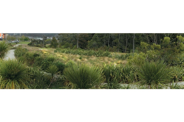
Urban development is an ever-present backdrop.
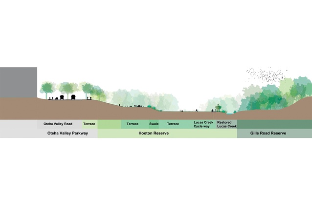
Site topography of the reserve and creekbed.
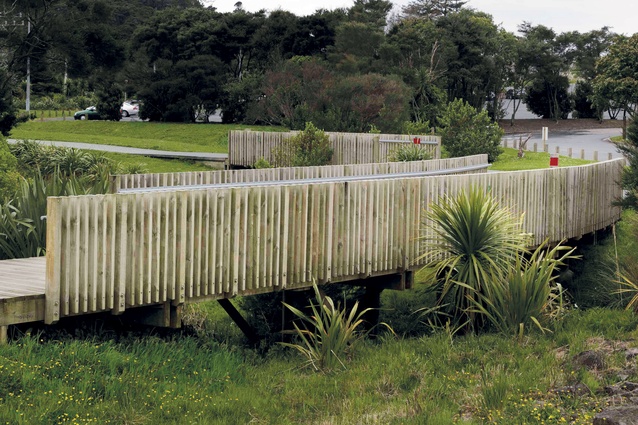
The cycle path winds through the reserve.
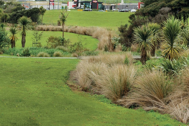
Swales of indigineous grasses.
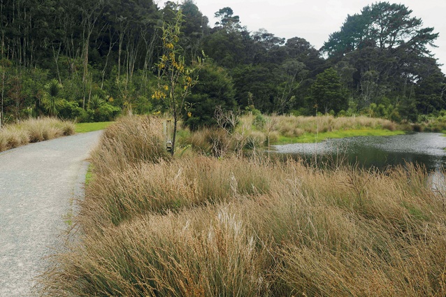
Stormwater retention pond.
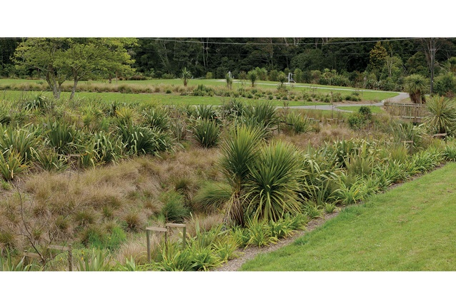
Mature vegetation integrated with new plantings.
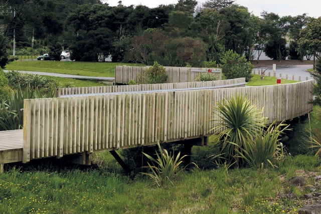
The project involved stream bank restoration, removing weeds, introduction of native riparian plants and providing a walking path with viewing platforms.
Bounded by the motorway and enveloped by suburban sprawl, this long-neglected creek bed has been restored – aesthetically and ecologically – and stitched into its surroundings.
By the late 2000’s Albany City, one of Auckland’s northern suburbs, had just finished its last burst of speculative growth with the construction of Westfield Albany and big-box retail along Oteha Valley Road. The Lucus Creek was a weed-choked steam at the far northern edge of the Albany City catchment. The creek cut through a steep and slipping embankment next to a council roading metal dump and the Albany stadium car park.
Bradbury McKegg (BMLA) was commissioned to develop an analysis and scoping study for Lucas Creek, from the old Albany settlement to the head of the catchment at East Coast Bay Road. At the completion of the study BMLA was asked to design a streamside path and a new park at the Hooton Reserve, adjacent to the Lucas Creek corridor. This reserve links the stream with the Oteha Valley Road, a four-lane highway, and the big-box urban form of much of Albany.
Commentary: Dr. Katrina Simon
The new Hooton Reserve and Lucas Creek cycle path is a linear park that runs along a creek valley at Albany Town Centre’s north perimeter. A quick virtual return visit to the site via Google Earth reveals a sinuous pathway picked out in a band of planting, poised between two contrasting landscapes – dense vegetation to the north and a looming temple to home improvement to the south.
A trip back in time along Google Earth’s historical imagery timeline shows how dramatically this landscape has changed in recent decades: from farmland in the 1960s to the current suburban development, ringed with large roads that define and link up a highly modified urban landscape characterised by large retail outlets and their attendant ever-expanding carparks.
The design of the park itself is part of another movement system that threads through this fragmented landscape – a cycle path that makes new connections between previously disconnected areas and takes advantage of the creek valley’s topography to make a traversable route along its length.
Landscape architects Bradbury McKegg have leveraged the commission for a cycle path to create a new public landscape that not only provides physical access and connection, but also uses spare fill from the stream restoration to create new terraces, daylights stormwater pipes to clean water flowing into and through the site, and incorporates plant swales to improve the water quality and vegetation quality of the creek.
In short, the design brings together the range of benefits that landscape architectural projects can offer to the urban realm when able to connect and integrate physical, biological and social systems, particularly in the delivery of urban infrastructural projects.

Some of the distinctive characteristics of this project are the ways in which the design mediates between the very disparate surrounding conditions, without trying to ignore or conceal them, and the use of age-old landscape devices to create surprising and useful new features for the park’s varied users. The reserve’s terrace structure has been carefully crafted into the existing topography, positioned between two boundaries that could not be moved in position or height – the creek and the road.
The upper terrace creates a level area adjacent to the road that enables cyclists and pedestrians to move along the route of the road, but separated from the traffic by distance and also by a new avenue of trees that further defines the boundary of the park. The lower terrace creates more areas for informal play, augmented by new facilities and connecting paths.
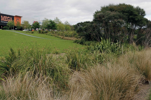
The establishment of these two new terraced areas with a large, generously planted sloping swale between them not only has created more useable space along a previously inaccessible and treacherous embankment, but also has given the parkland a much more legible and spacious quality. The swale, planted in masses of soft brown-coloured indigenous grasses, stands out against the the vivid green of the more level grassed areas, while denser stands of planting define the two new daylighted stream corridors and wetlands.

The variation in topography and planting is revealed along the gently undulating length of the cycleway, and further augmented by the unexpected counterpoint of the buildings and structures that appear as a changing backdrop.
From within the creek valley, the surrounding urban development has a presence, but a filtered and almost abstracted one. A bright orange Mega supergraphic logo on the adjacent Mitre 10 looms above the terraces at one point along the route, while from another, the curving white frame of the Albany Stadium arches over the harakeke. Further to the east, the sloping bank creates a strong silhouette against which the new protuberances of carpark lighting sprout from the adjacent site.
There is still a sense of rawness to the levelling and rearranging of urban structures that now contrasts with the park which has rapidly achieved an air of maturity and endurance, even though it is one of the most recent developments in the Albany area.