Onehunga Foreshore
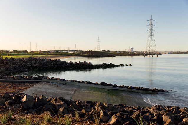
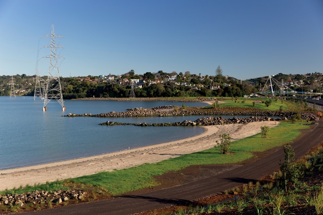
Looking southeast, rocky peninsulas extend into the water, separating each of the nine beaches. The boat ramp allows residents to once again launch directly into Onehunga Bay.
The precise construction of the rocky headlands, and planting over 42,000 individual specimens were among the most time- and labour-intensive aspects of the project.
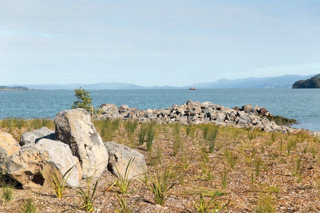
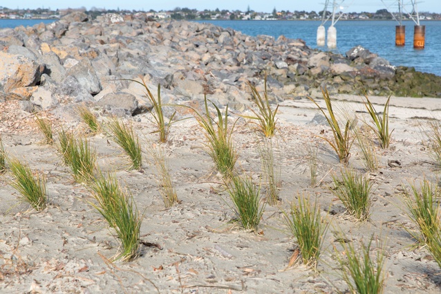
Native grasses and specimen trees soften the rocky headlands. There’s future potential to link this beach with the Waikaraka Cycleway and the future Taylors Bay coastal walkway.
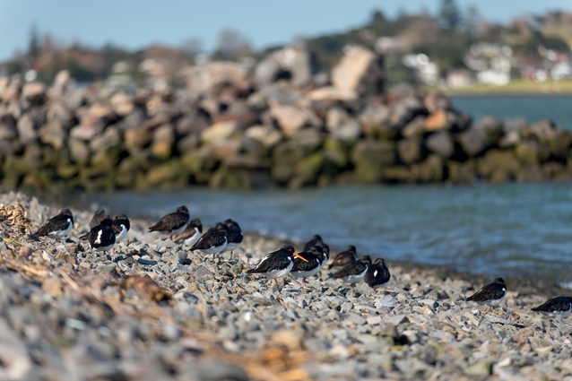
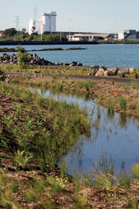
Marshy swales and gravel beaches provide appropriate habitat for native birds.
Native coastal plantings will restore the eco-system.
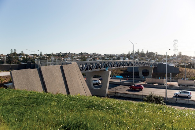
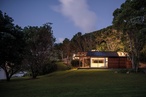
The wide, sloping bridge connects Onehunga to the new foreshore; embankments muffle the noise of passing traffic.

Marshy swales and gravel beaches provide appropriate habitat for native birds.
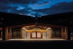
Looking back towards the Hillsborough bridge. The 3m-wide paths will soon be surfaced.
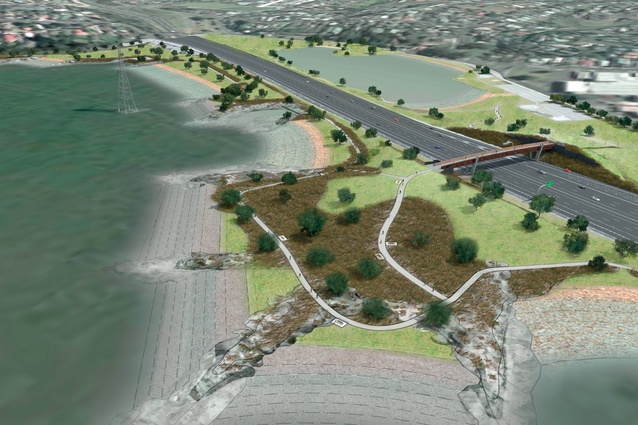
Artists impression. Even at the not-quite-finished stage, this is still an incredible visual transformation.
Thought to be the world’s largest-ever, and most comprehensive, reclamation project for recreational purposes, the much-awaited reconnection of Onehunga to the Manukau Harbour is nearly complete.
Almost forty years ago, the Ministry of Works extended Auckland’s Mount Roskill to Wiri motorway. Onehunga’s original beachfront esplanade was removed, the Southwestern Motorway (SH20) was built across Onehunga Bay and residents were effectively cut off from the water. Now, the Onehunga Foreshore Restoration Project, which is thought to be the world’s largest such coastal reclamation project for recreational purposes, is nearly complete.
Isthmus’ design concept restores a natural character to the coastal edge, building on the existing geology to recreate a landform reminiscent of the original Onehunga Bay. Five Maori tribes with traditional links to the area – Ngati Te Akitai, Ngati Te Ata, Ngati Tamaoho, Ngati Whatua and Te Kawerau o Maki – have a kaitiaki (guardianship) role in the project. In fact, when some 200,000m³ of general fill material was sourced from other locations, including the nearby Waterview Connection project, a karakia was performed over the site. The tribes also provided advice and commissioned artworks and signs that will help tell the story of the area.
Most importantly for local residents, the project includes a pedestrian and cycle bridge over SH20 to link the new foreshore to the existing Onehunga Bay Reserve, reconnecting the community to the harbor.
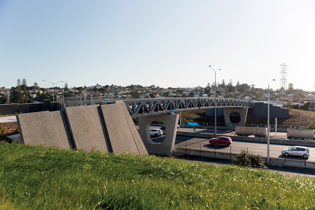
The gateway feature bridge is wide, low, and unobtrusive, embedded into two earth ‘headland’ mounded abutments on each end. In this way the bridge is integrated with the surrounding landscape and the coast. Falling away from the bridge abutments, the strategically placed mounds of earth rise above the shore level. Standing at the water’s edge, or in the reserve on the Onehunga side, these unobtrusive barriers help to mitigate the sight and sound of the adjacent motorway.
The 6.8-hectare seaside park will feature nine beaches. As well as three sandy beaches for swimming, the Onehunga shoreline provides heavily-planted gravel and shell beaches, which will provide a habitat for native coastal birds. Oyster-catchers and seagulls are omnipresent, and New Zealand’s endangered dotterels have already made a comeback. About 30,000 plants and 350 trees have been planted in recent months, with the grass already starting to come through.

Isthmus’s design is in-keeping with the local vernacular of New Zealand’s weathered west coast beaches. New basalt outcrops, promenades, undulating shell banks and intertidal sandy flats, and extensive planting of native grasses and specimen trees throughout the site will beautify this long-neglected area and enhance biodiversity.
Along with environmental considerations, the design encourages diverse recreational experiences to maximise community benefit. The boat ramp, pedestrian and cycle paths – along with typical park facilities such as a toilet block, park furniture and carpark – offer a variety of options. When opened for public use this summer, the beachfront will restore to the local community and wider region outdoor recreational opportunities and facilities within walking distance of the Onehunga town. Within the broader regional context, this newly-created beach and bridge present the potential to string together a network of bays, beaches and headlands around the Manukau Harbour from Green Bay to Stonefields.
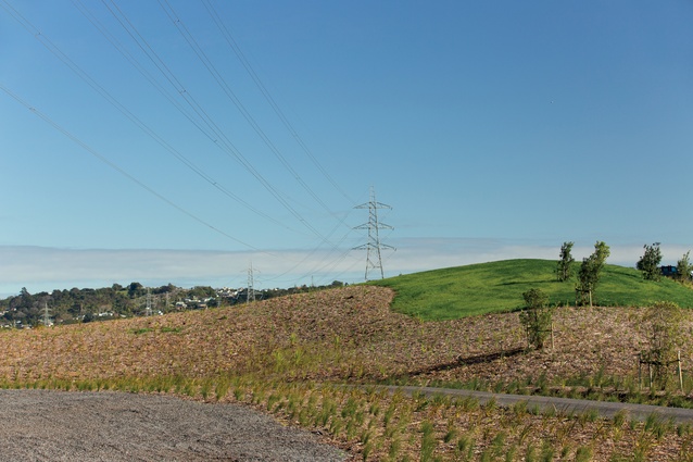
Not everything can be brought back to the way it was before. The Onehunga coast was dramatically modified as Auckland grew, and the esplanade at Onehunga Bay became a pathway for power, gas, water and telecommunications lines. This project does not involve removal of any transmission lines and pylons.

Early on, Iwi and public health officers were worried about the hazards to people bathing in the long-polluted lagoon and bay. Significant work was done to get the water quality up to swimming standard. Drains discharging into the bay were tested for sewage pollution due to cross connections, leaking waste pipes or waste water overflows to pinpoint and mitigate all sources of contamination.
Even at the not-quite-finished stage, this is still an incredible visual transformation. The rocky outcrops extending into the water and strategic undulations hiding the motorway manage to soften the impact of those huge power cables, which previously dominated the view. In a couple of years when the foliage has grown in, it will look even better. It has been a long road to this point. Years of relentless community action, and support from local council members to keep the Onehunga foreshore on the Auckland political agenda, resulted in a plan being put in place to restore to the community something that should never have been taken away.
And that is where the real significance lies. The Onehunga Foreshore Restoration Project has wider national implications than simply serving as an exemplar for re-creating a beach in South Auckland, or beyond. It is ultimately a lesson – a long and expensive lesson – in the consequences of misinterpreting what ‘progress’ and ‘growth’ mean in a residential urban context.
We all agree that our growing cities require infrastructure, but thoughtful city-building must be based on a holistic range of imperatives, rather than defaulting to the most expedient way to move from A to B.